
Anyone need spatial data on forest status in East Kalimantan, please follow this link and you could download shapefile format of the data.
https://drive.google.com/open?id=0B5TgHjfSZOMXX0dTUHBiWTBIVkk
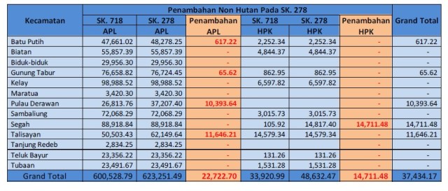
As you can see from table and chart below, some additional areas designated for APL (read: oil palm).

Additional area were in Berau as you could see from table below:
Regulation in decree format could download with this link: https://drive.google.com/open?id=0B5TgHjfSZOMXbHpsX0cxTUh2QVU

