
All photos taken during my trip to San Diego and Colorado. San Diego trip for participated in ESRI User Conference 2015 from July 20-24. Colorado trip for some training and also technical discussion for Development by Design approach.
Leaving at nigh in Jakarta, I will arrived morning in Tokyo for layover. My plan to have 10 hours layover and travel in Tokyo cancelled due to no visa and no flight available.
This will be photography posting, but every trip should bring something to learn.
If you like to have a picture, make sure that you choose window seat and avoid seat at wing part (middle row), you have to choose whether front of far in back seat.
DSLR camera will be great, you can use tele lenses that makes you possible to get more detail photos.
I used my iphone 5s to take all pictures.

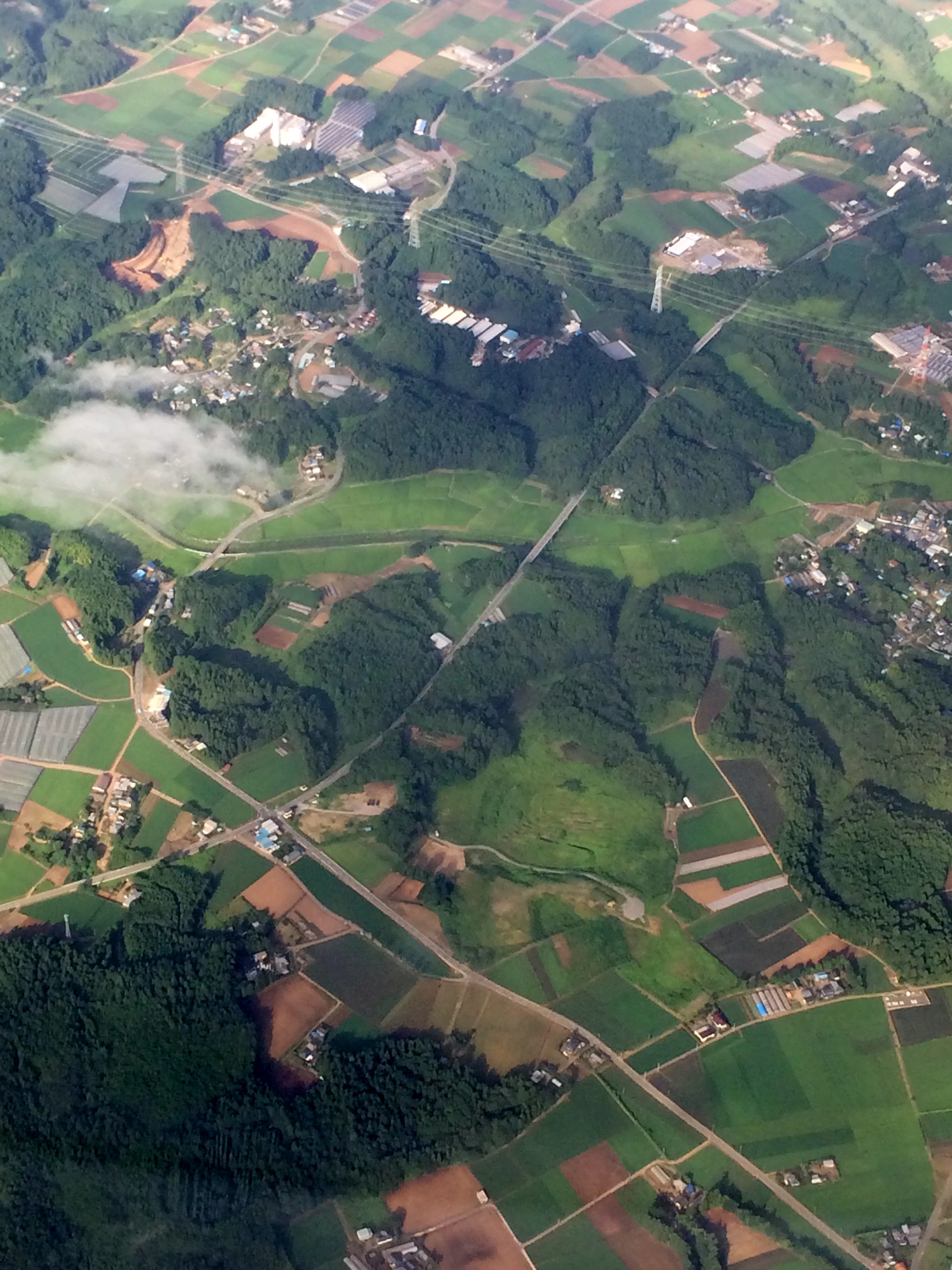
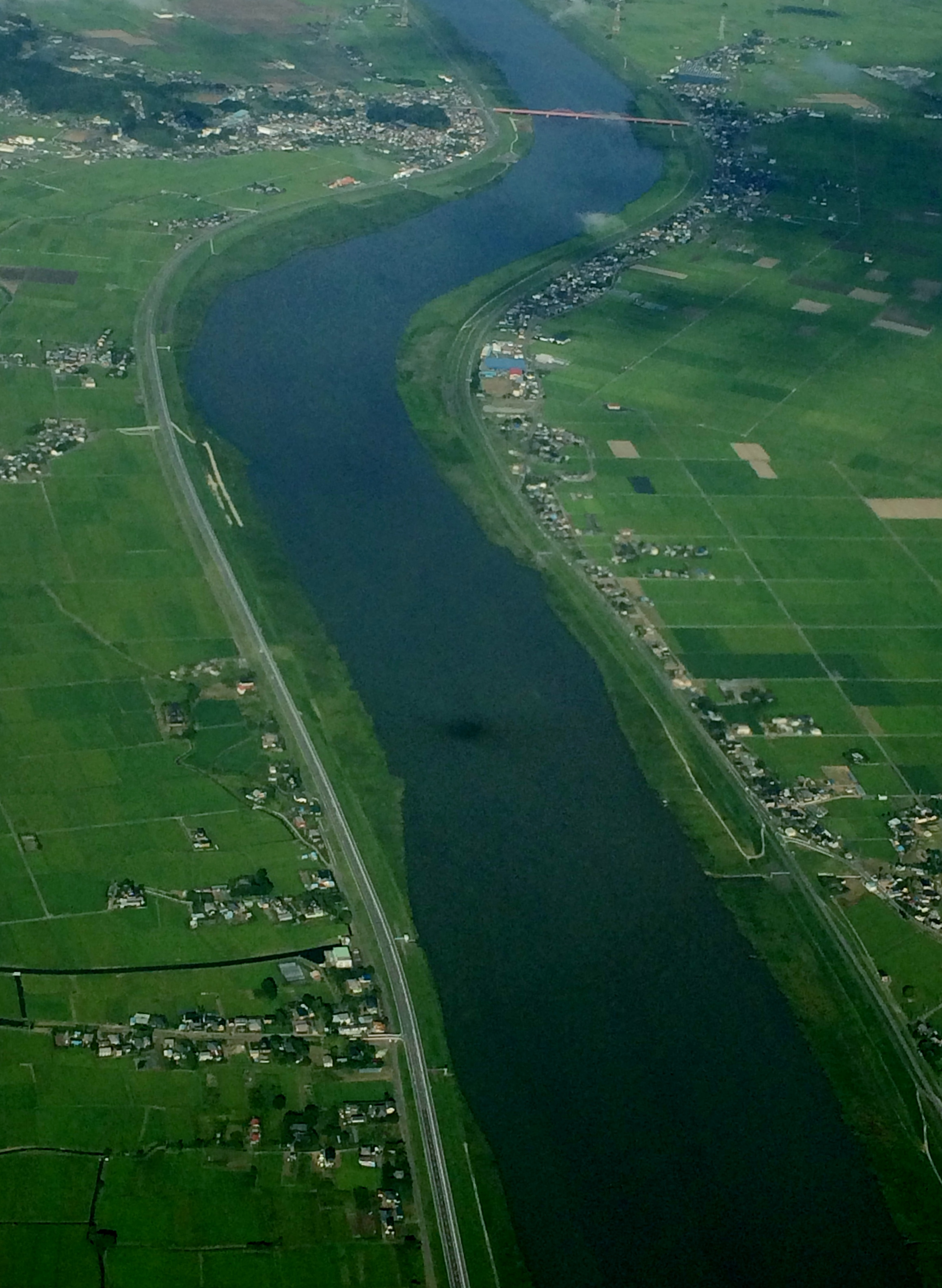
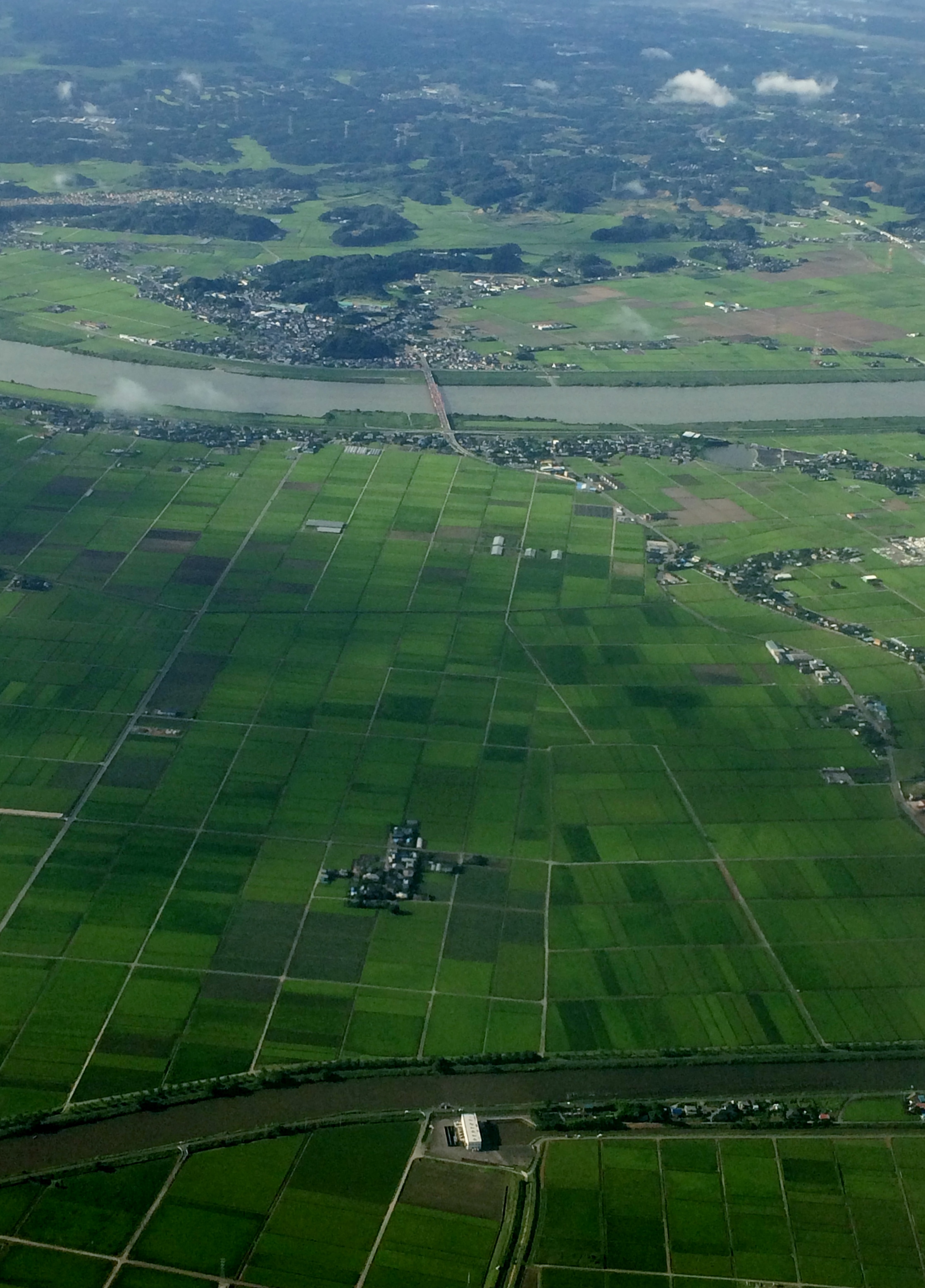
This portrait photos that showing more about information in vertical. You should takes portrait for feature such as roads or river.
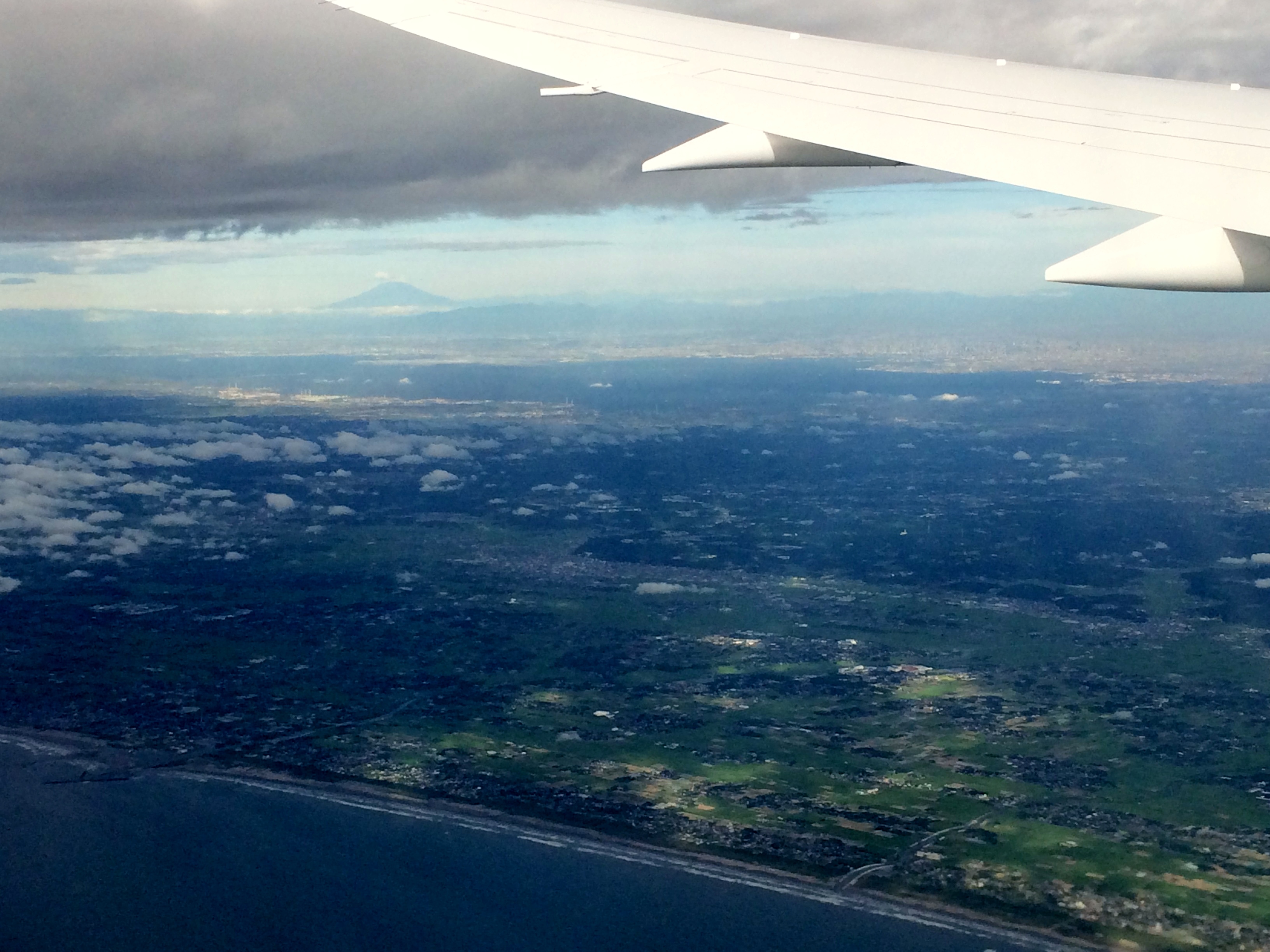
Almost all international flight provided trip maps with actual GPS position. You can capture by camera to see where you are.


Japan is a modern country with very good infrastructure. This infrastructure provided not only at urban areas but spread cover all country including rural areas. This fact different with developing countries that leave gap between facility at rural and urban areas.
Rural areas also develop with a good planning. As regional planner, I am jealous that good planning implemented in all areas. River banks should clear from building and there supposed to be an open areas. Later when this area develop into semi urban or urban areas then this river bank could be a very nice place for parks or other recreational areas.
You can see from above that infrastructure such as road, bridge and other facility develop in good quality even at farming areas. Wide road, long bridge anticipated for long period.


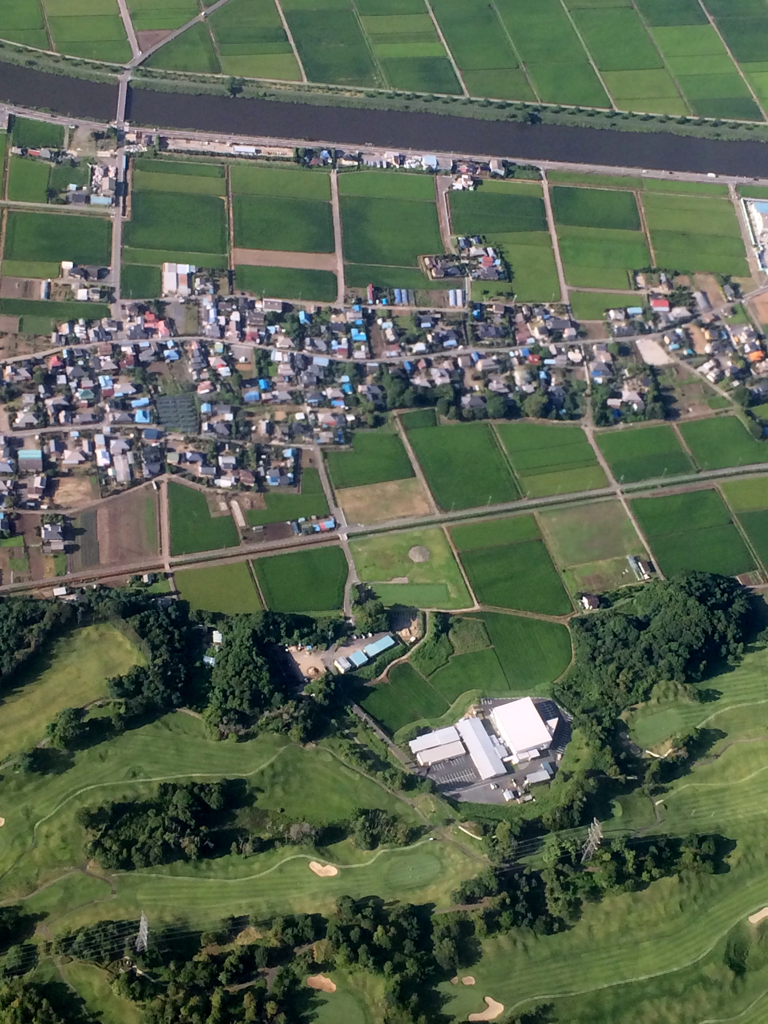
From above I could see good quality settlements and also some building for further crops processing unit.

You can also see that even at rural areas there are shops and other public facility with a good quality parking lots and this building surrounded by nice tree cover.

As you can see some areas remaining cleared, I assumed that this is forest area.
You might surprise to see below picture huge roads and also a cycle turn in paddy field. How this happen? Based on my prediction that this development to anticipated long term development plan. With this anticipation government provided more secure transportation issue for next 10 and maybe 25 years ahead.

I am wondering that some lesson learnt from this will use for development planning, transportation planning in Indonesia

